This map shows the boroughs of Johnstown and Conemaugh in 1854.
Donated for scanning by David and Sharon Swain
This map shows the boroughs of Johnstown and Conemaugh in 1854.
Donated for scanning by David and Sharon Swain
This map shows the no longer existing “Goose Island” area of Johnstown. Sun damage has faded this map and you will need to zoom in to see its details. This map dates from March 1915 and is based on deeds from the Cambria Iron Company. Goose Island existed during the Canal Era in Johnstown 1834-1854.
Donated for scanning by David and Sharon Swain

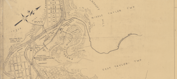
This map of early Johnstown and vicinity shows the location of charcoal iron furnaces, forges, ore deposits, and other features of historic interest. Map dated 1932.
This map shows the layout of Johnstown in 1854.
Donated by Alison McKissick in memory of her father, James F. Clark
This image shows the Pennsylvania Railroad Train Yard in Conemaugh before the 1889 Johnstown Flood.
This image shows the Pennsylvania Railroad Train Yard in Conemaugh after the 1889 Johnstown Flood.